
Proposed Middle Bank Marine Sanctuary
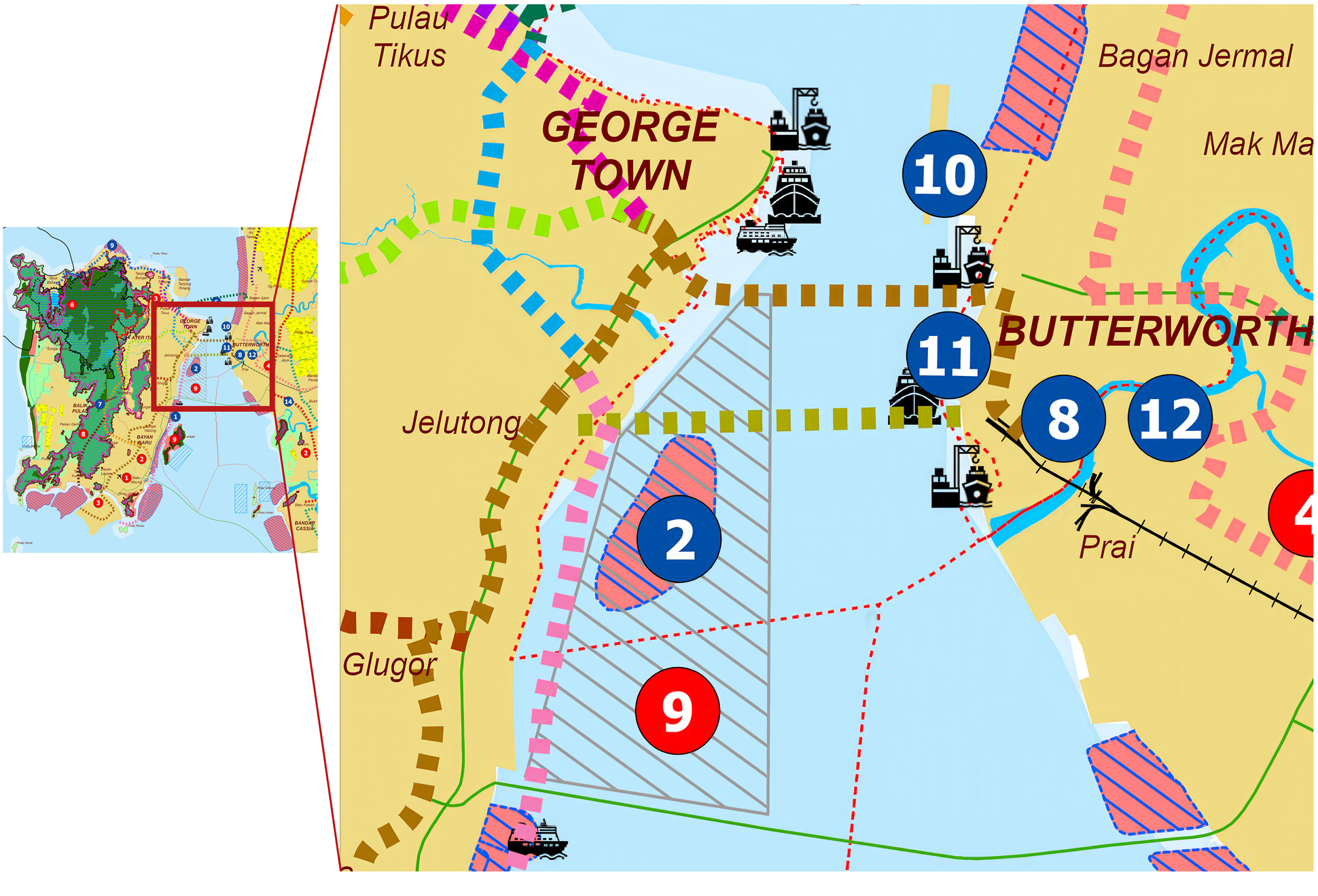
The pale-blue area with grey diagonal lines identifies the proposed Middle Bank Marine Sanctuary on the supplied planning map. It is a proposed designation, not proof of gazettement.
The sanctuary appears as High-impact Project 2.
The blue number 2 identifies “Middle Bank Marine Sanctuary” as High-impact Project 2, one of 14 high-impact projects proposed in the draft plan. It is a planning designation, not proof that a sanctuary has been gazetted.
On the supplied map, this sanctuary designation overlaps the pink area with blue diagonal hatching used for proposed reclamation. The map shows overlapping designations; it does not establish a surveyed overlap area or project approval.