The Forest Beneath the Sea. A whole world of life.
Seagrasses are marine flowering plants. At Middle Bank (Tebing Tengah), their meadows create habitat for young fish and invertebrates (animals without backbones), connect coastal food webs and help hold sediment in place.
Meet three communities, follow the tide and discover why these living meadows matter to Penang.
A community is a group of organisms living together. These three community types are named for the seagrasses that dominate them. They are not three species.
Growth-form illustration · not to scale
01 / 03
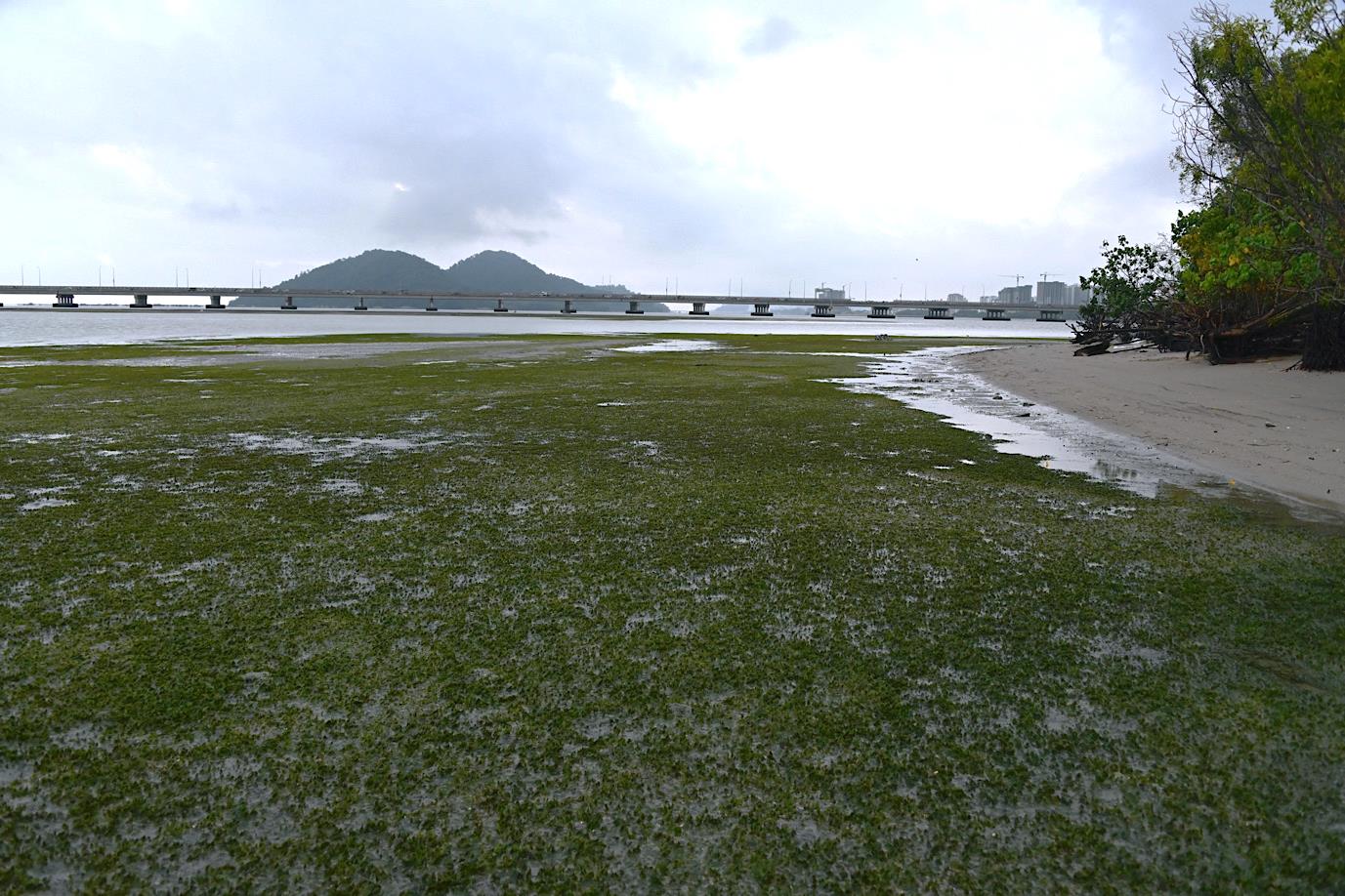
Halophila community
Halophila ovalis
Growth form
Small, spoon-shaped leaves form low, creeping turf. The report uses the common names spoon grass and dugong grass.
Where the report describes it
Around the mid-tide zone of Pulau Gazumbo and southern Middle Bank.
Life around the plants
Wading birds, very small juvenile fishes, bivalves and gastropod snails are associated with this habitat. Fish use water-covered areas, pools or channels.
Why the structure matters
Low vegetation and the surrounding sediment provide feeding and habitat space for small animals.
“Dugong grass” is a common name, not evidence that dugongs occur at Middle Bank.
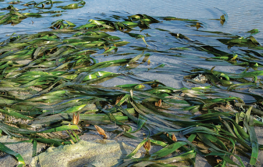
Long leaf blades create a taller canopy: a layer of leaves above the seabed. Local names in the report include Jerangau Laut and Setul.
Where the report describes it
From the middle to the northern section of Middle Bank.
Life around the plants
The stands provide shade, shelter and surfaces where other organisms can live.
Why the structure matters
Roots and horizontal stems anchor the plant in sediment; the leaves add three-dimensional habitat above it.
Kew describes leaves that can exceed one metre. This is a species description, not a measurement of every Middle Bank plant. “Eelgrass” is an ambiguous common name.
Table 8-1 lists seven seagrass species. Explore the original inventory records below; names and page links come from the same site dataset as the biodiversity page.
Choose a water level. Look for what is exposed, what stays underwater and where a small fish can move. The plants remain the same size.
Low tide: part of the bank is exposed
Water remains in lower areas. A fish is shown in the water-filled channel; a wading bird uses the exposed edge. The meadow is not empty simply because the water has fallen.
High tide: water covers the bank
The same plants are now submerged. Water connects more of the illustrated habitat, giving aquatic animals access above the bank. This shows a general process, not a measured movement route.
Conceptual illustration—not a tide forecast or surveyed habitat map. Positions, depths and plant sizes are illustrative.
Read the plant from leaf to root
1
Leaves
Above the sediment: capture light and create structure.
2
Rhizome
A horizontal stem in the sediment; connects shoots.
3
Roots
Extend into the sediment and help anchor the plant.
The report documents artisanal fishing and shellfish gathering around Middle Bank. Habitat protection belongs in the same conversation as access and fishing families.
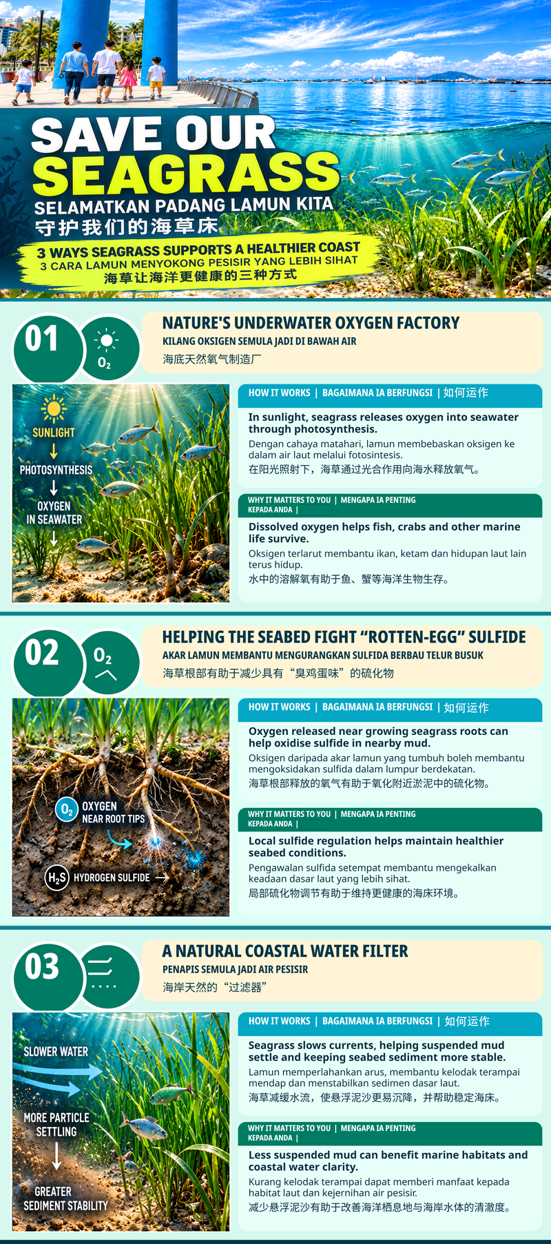
Below-ground plant structures bind sediment, while a canopy can slow water and reduce sediment movement, helping water clarity. Effects depend on local conditions; no fixed protection percentage is implied.
Seagrass ecosystems contain carbon in plants and sediment. Storage, accumulation and net climate benefit are different questions and need appropriate measurements.
You can also use your browser’s Print command. Text downloads are available for offline use.
Halophila communities in the green foreground around Pulau Gazumbo at low tide, as identified in the report. Photo 6-1 · printed p. 12. Penang Institute / CEMACS · 2023
A dated window into Middle Bank
The community descriptions below come from the 2023 Penang Institute / CEMACS report. Its first-phase surveys ran from October 2021 to March 2022. These are historical observations, not a survey of the meadow today.
Both use sunlight, but seagrasses are flowering plants with true roots and stems. Seaweeds are algae. A rhizome is a horizontal stem, not a root.
Explore three communities
A community is a group of organisms living together. These three community types are named for the seagrasses that dominate them. They are not three species.
Three communities. Seven listed species.
Table 8-1 lists seven seagrass species. Explore the original inventory records below; names and page links come from the same site dataset as the biodiversity page.
Growth form: Small, spoon-shaped leaves form low, creeping turf. The report uses the common names spoon grass and dugong grass.
Where the report describes it: Around the mid-tide zone of Pulau Gazumbo and southern Middle Bank.
Life around the plants: Wading birds, very small juvenile fishes, bivalves and gastropod snails are associated with this habitat. Fish use water-covered areas, pools or channels.
Why the structure matters: Low vegetation and the surrounding sediment provide feeding and habitat space for small animals.
Growth form: Several seagrass species share a stand and may be co-dominant: no single species has to define the whole patch.
Where the report describes it: Intermediate areas beyond the dominant stands, as described in the report.
Life around the plants: Small invertebrates and juvenile fishes can use connected patches of habitat.
Why the structure matters: Different plant structures help form a habitat mosaic. The report describes these communities as extending the space available to small animals.
Low tide: part of the bank is exposedHigh tide: water covers the bank
1 — Leaves · 2 — Rhizome · 3 — Roots
Follow the tide · What was observed—and what still needs testing?
Low tide: part of the bank is exposed
Water remains in lower areas. A fish is shown in the water-filled channel; a wading bird uses the exposed edge. The meadow is not empty simply because the water has fallen.
High tide: water covers the bank
The same plants are now submerged. Water connects more of the illustrated habitat, giving aquatic animals access above the bank. This shows a general process, not a measured movement route.
Conceptual illustration—not a tide forecast or surveyed habitat map. Positions, depths and plant sizes are illustrative.
Reported observation · 2023 publication: The report described seagrass deterioration in parts of Middle Bank.
Proposed explanation · not an established cause: It suggested coastal erosion and changes in the substrate as possible explanations, with further study needed. This passage does not measure the present extent or prove a cause.
Use the community cards and the dated evidence note. Support your answers with a page reference.
For each community, record one characteristic plant, its growth form and its reported location.
Choose one community. Explain how its structure can provide habitat for another organism.
At low tide, why should a fish be shown in a pool or channel rather than on exposed sediment?
Write one reported observation about deterioration and one proposed explanation. What evidence would help test that explanation?
Can you read a seagrass meadow?
How do the three community types relate to the seven species?
Each community is one species, so there are only three.
Community types describe how species grow together; the inventory lists seven species.
The numbers measure the same thing.
Which feature best describes the Halophila community?
Low, creeping spoon-shaped leaves.
A forest of mangrove trees.
Only long ribbon-like leaves.
What does the taller Enhalus canopy add?
A guaranteed barrier against every coastal hazard.
Proof that all roots are the same depth.
Shade, surfaces and habitat structure for associated life.
What defines a mixed community?
Several seagrass species growing together.
A mixture of plastic and sediment.
A habitat without seagrass.
Does the report establish why the meadow deteriorated?
Yes: every proposed cause is proven.
No: it reports deterioration and proposes explanations needing study.
Yes: it measures the meadow today.
Learning goals
Compare three communities using evidence.
Explain one link between plant structure and animal habitat.
Distinguish an observation from a proposed explanation.
Materials & preparation
A screen or printed source cards, paper and a pencil. Load or download this page before class. No account, specialist equipment or visit to tidal flats is needed.
A 20-minute sequence
0–4 min
Notice
Look at the photograph (or its description in the text pack). Describe two features; separate what you see from the report’s identification.
4–10 min
Compare
Use the three source cards to complete the community comparison.
10–15 min
Connect
Compare the two tide states. Explain where a small fish can remain at low tide.
15–20 min
Check the evidence
Discuss observation versus proposed cause, then complete the five-question check.
Teacher answers & assessment
Halophila: H. ovalis, low creeping turf, Pulau Gazumbo and southern bank; Enhalus: E. acoroides, long leaves, central to northern bank; mixed: co-dominant species such as T. hemprichii and H. beccarii in intermediate areas. Report pp. 11–12.
Accept a supported connection, such as taller leaves providing shade and surfaces, or mixed patches extending habitat for small animals. Do not require an invented abundance estimate.
Fish need water. Pools or channels can retain water as parts of the bank become exposed; the illustration is conceptual.
Observation: deterioration described in the report. Possible explanation: erosion or substrate change. Repeated comparable habitat surveys, sediment measurements and consideration of alternative causes could test it. The passage alone does not prove causation.
Check that learners use evidence for all three comparisons, explain one structure–habitat link and label the cause as a hypothesis. Accept equivalent wording. Quiz answers: 1 B · 2 A · 3 C · 4 A · 5 B.
Yasin, Z., Tan, A. S. H., Lee, A., Woo, S. P., & Razali, N. (2023). Protecting Penang’s marine biodiversity: Establishing the Middle Bank Marine Sanctuary (MBMS). Penang Institute.
A historical inventory compiled from long-term research and the 2021–2022 surveys, not a 2026 census. Bird records include surrounding coastal areas; mammal and turtle records include wider Penang waters. Fish rows 96 and 97 repeat Plicofollis platystomus, so the reported total is not a deduplicated species count. Sanctuary and meadow areas differ, and some habitat-area text and percentages require reconciliation.
Seagrass-Watch. (n.d.). What is seagrass? Retrieved October 18, 2026, from https://www.seagrasswatch.org/seagrass/
An educational reference, not a Middle Bank field survey. Global numerical comparisons and thresholds on the source page are not adopted here.
Royal Botanic Gardens, Kew. (n.d.). Enhalus acoroides (L.f.) Royle. Plants of the World Online. Retrieved October 18, 2026, from https://powo.science.kew.org/taxon/urn:lsid:ipni.org:names:160634-3/general-information
A botanical reference, not a measurement of Middle Bank plants. It does not corroborate the report’s 1.5 m root-depth claim or a global size superlative.
Reidenbach, M. A., & Thomas, E. L. (2018). Influence of the seagrass, Zostera marina, on wave attenuation and bed shear stress within a shallow coastal bay. Frontiers in Marine Science, 5, 397. https://doi.org/10.3389/fmars.2018.00397
Different species, climate and coastal setting. Its numerical results must not be presented as measured protection or predictive values for Penang.
Lavery, P. S., Lafratta, A., Nair, D., Ponnampalam, L., Ng, J. E., Fairul Izmal, J. H., Serrano, O., & Masqué, P. (2023). Blue carbon opportunities: Seagrass carbon storage and accumulation rates at Johor and Penang, Malaysia. Edith Cowan University and The MareCet Research Organization. https://doi.org/10.25958/zfxg-0y62
A technical report, not a journal article. Sampling conditions, core depth and spatial coverage must be reviewed before extrapolating any figures to the meadow or sanctuary.
A note on measurements
The report’s statement about roots extending more than 1.5 m and its global “largest seagrass” wording have not been independently corroborated for this page. Neither is used as a teaching fact or a diagram scale. Leaf length, root depth and rhizome size are different measurements.